|

|
|
|
|
Danish UAT Weather & Traffic Trial
|
AOPA DMU Denmark is cooporating with the flightplanning provider Air Support A/S to establish a network of groundbased UAT transmitters that will broadcast weather in the form of weather radar images, TAFS and METARs for aviation use. The signal can be received by modern panel mounted avionics able to receive ADS-B signals or by small portable receivers which can display the information on for instance an ipad. The receivers will also make it possible to see other traffic that sends out ADS-B signals and some receivers even show FLARM traffic information typically emitted by gliders. Popular navigation software like Foreflight, SkyDemon and EasyVFR all support the technology and will display both traffic and weather directly in the app. The first transmitter was launched in Billund (EKBI) in April 2019 and published by notam - until further with the disclaimer that is not for operational use:
NEWS 10/07/2019: A second transmitter located in Roskilde airport was launched in July 2019. This page is dedicated to cover the Danish trial. We will test various devices and collect and provide feedback from and to pilots. All pilots with equipment that is able to receive the signal is encouraged to provide feedback to info@aopa.dk with observations or information that can help to improve the information provided here. For instance information about actually tested and compatible or non-compatible equipment, reception range or in case of problems with data quality. News 3/5/2021: UAT transmitters temporarily shut down - 8 new transmitters expected soon The two test ground stations are temporarily disabled since Garmin has withdrawn the data flow. We are expecting to soon launch 8 new transmitters so most of the country will be covered. The approval of the concept from the Danish CAA has been granted so only a technical approval is missing. News 13/1/2025: UAT transmitters still waiting for approval by the Danish CAA Since we are regularly receiving questions about the status of the promising UAT project in Denmark, we can inform you that an application for a fully functional and fully financed project to cover all of Denmark with up-to-date UAT weather was submitted to the Danish CAA more than three years ago in order to receive an authorisation to transmit on the UAT frequency. Despite several reminders the application has still not been processed or approved by the Danish CAA so the project is currently stalled.
What can we do now and what are the perspectives?
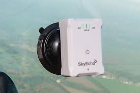
AOPA has for a long time been working to improve access to weather and traffic data in the cockpit in Europe. In the US the groundbased UAT transmitters has for years been established across the continent and transmits not just weather and notams but also traffic information from ATC radars so that the pilot is able to see not just traffic that sends out an ADS-B signal, but also traffic with a conventional mode C or S transponder, socalled TIS-B. The overarching perspective is of course to improve flight safety by weather related accidents and to reduce the risk of mid-air collisions. A US study shows that the effect can be quite remarkable: the likelihood of a fatal accident decreased by 89 percent for aircraft using ADS-B In. As we gain operational experience the plan is to supplement the current transmitter with 4-5 additional transmitters which should be enough to cover most of Denmark at altitudes from 5000ft and up. A similar trial is taking place in the UK and a transmitter has also been established temporarily in Friedrichafen in Germany. The hope is that all of Europe will eventually be covered as awareness and demand increases and receivers become more widespread. Currently, the Danish transmitters are limited to sending out weather radar images, TAFs and Metars. We expect that Notams will be added soon. This becomes increasingly relevant with drone areas beeing established more frequently through Notam and in the short to medium term the technology therefore also has the potential to reduce conflicts between drones and manned aviation. Eventually we would hope to be able to send out a live traffic feed of all traffic picked up by ATC radars like it is done in the US, but at this point this is still only a dream in Europe. With the existing setup pilots will only be able to see other traffic that sends out an ADS-B signal. Some receivers also allow to show FLARM signals typically emitted by gliders and some will show mode C and mode S transponder equipped aircraft as bearingless targets with an altitude indication. The hope is that the benefits in the form of inflight traffic and weather data will make more aircraft owners see the benefits of ADS-B equipment and choose to install the equipment on a voluntary basis. The more aircraft are equipped the more complete is the traffic information provided and therefore the benefit of the equipment. The installation cost of certified panel-mounted ADS-B in/out equipment is still considerable for GA. A UAT/ADS-B receiver however can be purchased at a modest cost of a few hundred Euros. In fact, one portable model on the market, the SkyEcho2, is not just a receiver but also includes a 20 Watt CAP 1391 compliant ADS-B transmitter that will send out the position of the aircraft so that the aircraft becomes visible for other traffic with an ADS-B receiver. As part of a comprehensive initiative to improve electronic conspicuity the UK CAA has permitted the use of the transmitter. It is currently not allowed to activate the transmitter in Denmark, so the unit must be configured in receive-only mode, but we hope that the Danish CAA will support a similar initiative in the interest of improving flight safety.
Which UAT receiver should you buy?We refer to this excellent comparison of UAT receivers in the market. You can ignore comments about the Sirius-XM sattelite reception since this is not available in Europe. Below you will find reports on receivers we have actually tested in Denmark.
Practical ExperiencesBelow we will report on practical experiences with UAT and ADS-B technology. The transmitters established in Billund and Roskilde are provided by Garmin and the signal should be compatible with all standards compliant UAT receivers on the market. In practice we have so far successfully tested the reception with the following receivers:
All devices are able to receive ADS-B traffic and UAT weather but each device has it particular additional benefits such as AHRS, CO detector, ADS-B transmitter etc. Some devices are limited to only work with certain apps. We hope to provide you all the details here as we progress with the testing. What is the range? The UAT signal is limited to line of sight and in practice our experience is that the reception range is a little shorter than for instance the distance where a VHF radio signal can be received. Maybe because the device used for the test was not linked to an external antenna. So far we have made the following real life observations about the ability to receive UAT weather data from the Billund transmitter. In practice it is possible to pick up the signal well into Northern Germany from an altitude above 8000ft:
What is the coverage? The Billund transmitter sends out weather and radar images for a radius of 300NM meaning that when you are within reception range you will get weather covering the area from around Oslo to somewhere between Hannover and Köln. See the image to below to get a feeling of the coverage.
Practical Test with SkyEcho2Data connection and UAT reception
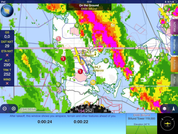
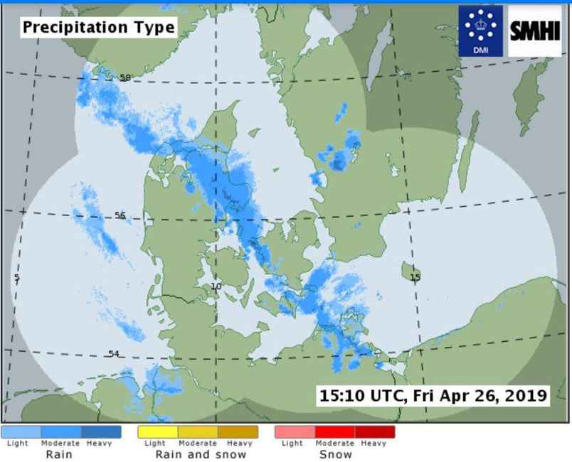
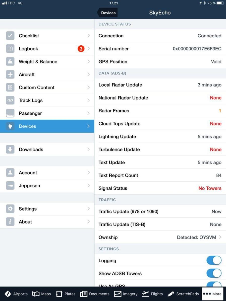
Below is shown the radar image received via UAT and the weather from Flygmet - the official Danish provider of aviation weather. Both screenshots are from around the same time. There is good correspondance, but it would appear that the UAT weather data has higher sensitivity. Some of the green precipitation shown just southwest of the aircraft position is not shown on the Flygmet image. In practice there was thick clouds with light drizzle in the area. Note the little green light under the weather tab in SkyDemon. This indicates good reception of the UAT signal. The light will change to yellow and red when the reception deteriorates but SkyDemon does not provide details about what exact UAT data was received and how old is the latest data. Foreflight (last image) has a very nice overview page that will show you how old is the UAT data and what kind of data was received.
ADS-B Traffic reception High-level traffic with ADS-B out from across most of Denmark is visible even on the ground so it is our impression that reception quality is really good even without an external antenna. An altitude filter in SkyDemon allows to filter out traffic above a certain height, if you know it will not be relevant. We did experience that the amount of distant traffic shown would decrease significantly when the aircraft avionics was turned on. A closer investigation revealed that the culprit was the aircraft DME. With the DME off all remote targets were again visible. Moving the SkyEcho2 device around the aircraft did not change the situation. The problem could be particular to the aircraft and the DME antenna installation. Also we are unable to conlude if this is a genuine problem or not. After all far away traffic has little relevance for collision avoidance. It would need to be investigated further if the operation of the DME could also interfere with the ability to see close-in traffic in certain angles. FLARM traffic reception During flight we also regularly picked up FLARM signals from gliders and hanggliders. These were however more flimsy and would tend to come and go - probably because of the relatively weak signal from the FLARM transmitter that is really intended for traffic avoidance on short distance. It is still to be investigated if the FLARM signal would also be more stable with the DME turned off. Note that contrary to the ADS-B signal which is public domain and can be decoded by all receivers, the FLARM signal is proprietary and requires a special license to decode. Therefore SkyDemon will charge an additional fee of approx. Euro 35 to display FLARM targets. An additional limitation for FLARM reception is that the SkyEcho2 unit uses the same antenna for receiving the UAT signal and the FLARM signal. Therefore you will need to choose which signal you want to receive. The receiver unfortunately cannot receive both signals at the same time. The configuration choice is made in a browser on a device specific web address that you should bookmark for easy access. When weather is good or you are not within reception range of a UAT transmitter use it for FLARM. If weather becomes a concern you can switch to UAT reception. Quite often the two situations would not coincide but still it is an extra thing you need to care about and hopefully a future version of the unit would have a dedicated FLARM antenna to overcome this limitation. Note that the unit does not transmit a FLARM signal. However, if you already have a FLARM unit it can be connected via a special FLARM bridge. Reception of traffic data from Mode C and mode S transponders As a relatively new feature the SkyEcho2 is also able to pick up signals from mode C and mode S transponders. However, since these only carries altitude information and no position data the data can only be presented as a bearingless target without a position or distance. The feature is currently only supported by EasyVFR so we have not been able to test it. In crowded airspace we suspect it might lead to many false alarms, in other areas it might be OK to use. We are yet to be convinced of the value and it is a feature that can be disabled if you don't like it. ADS-B Transmitter A unique feature of the SkyEcho2 unit is the built-in ADS-B transmitter which brings two-way electronic conspicuity into a price range that makes it attractive to many GA pilots and aircraft owners. Currently the transmitter functionality is only allowed to be activated in the UK, but we hope to get it approved also in Denmark. The SkyEcho2 manual will state that it is not allowed for use in an aircraft with an operable transponder, but the UK CAA has permitted simultaneous use of the SkyEcho2 unit in aircraft with an operating transponder as a special trial. The main concern about simultaneous use is that the portable unit must be encoded with the same HEX code as the aircraft transponder. If not, ground based radars might display two aircraft at the exact same location which could cause some concern by ATC. If the portable unit is always used in the same aircraft there is little risk of problems, but if the unit was moved around between several aircraft there would need to be a high discipline to verify the encoding before flight. PROS and CONS of the SkyEcho2 PROS:
CONS:
Note: If you want to order the SkyEcho in Europe you should order it from the European uAvionix shop which you find here: https://uavionix.store/general-aviation-ads-b-transceivers
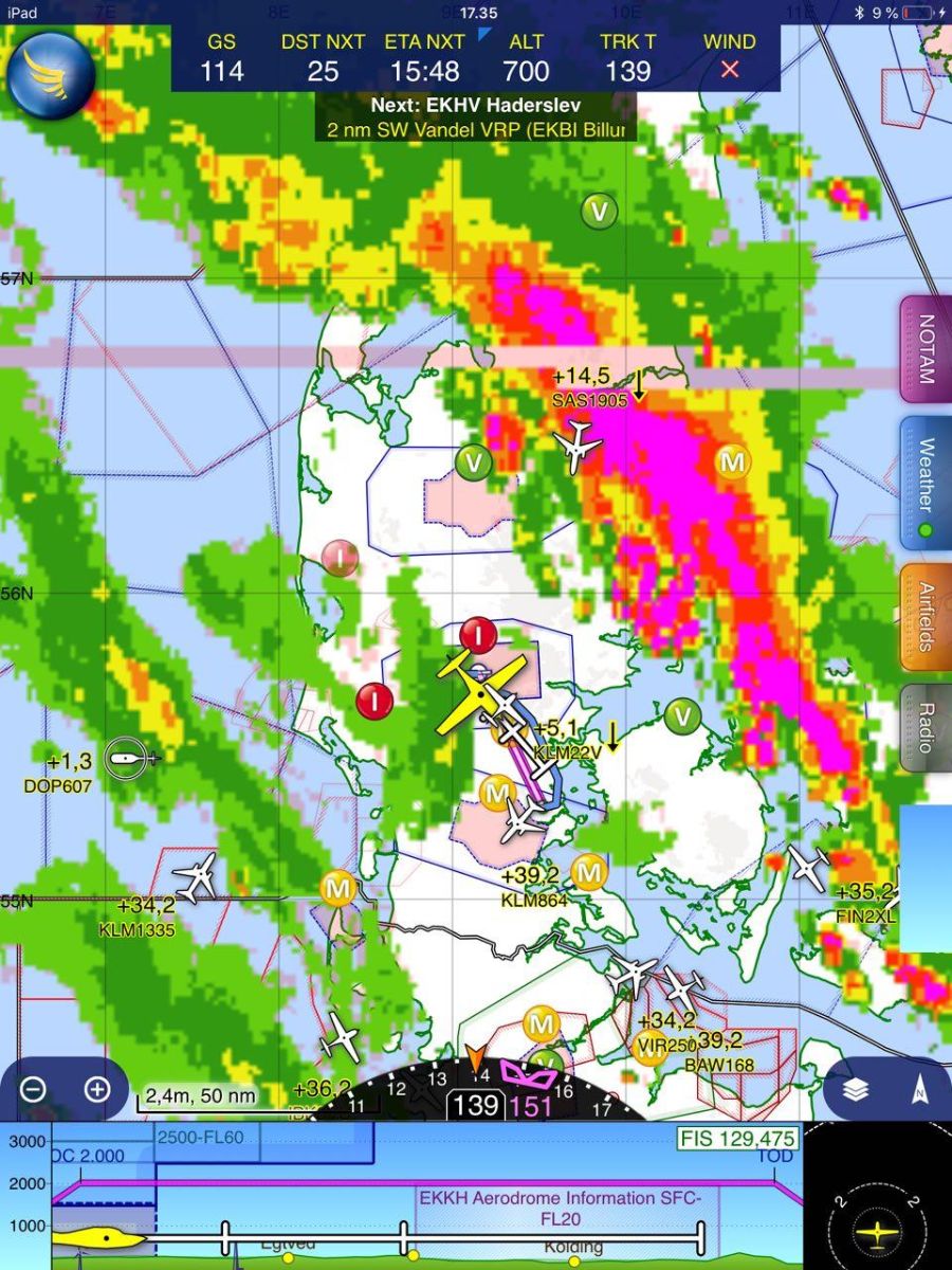
User screenshotsBelow you will find some user screenshots sent to us to illustrate features and utility of the system.
|

 We tested the